One map language, all over the world: ISOM
A runner in Sweden reads an orienteering map drawn in Ankara exactly as we do. The map specifications of the International Orienteering Federation (IOF) make that possible. This page sums up what ISOM says, why sprint maps are different and how maps are approved in Turkey.
Based on ISOM 2017-2 Rev. 6 (January 2024), ISSprOM 2019-2 and the IOF Competition Rules 2026. Last updated: 28 September 2026.
What is ISOM and why does it exist?
In the early days, orienteers raced on small-scale state topographic maps, sometimes as small as 1:100,000. Special orienteering maps appeared in the 1950s, but every country used its own symbols. Fair international competition needed a standard, and the first official ISOM was published in 1969. In 1972 green was introduced to show runnability, and orienteering maps began to look much as they do today.
ISOM’s guiding principle is legibility: the map is read while running, in the shade of a forest, in the rain. So the specification asks the mapper to draw the terrain not “as it is” but generalised in the way that serves the runner. The aim is that results are decided by navigation skill, not by faults on the map.
A short history
- 1969The first official ISOM is published.
- 1972Green is introduced to show runnability.
- 1990sDigital cartography: maps move from pen and ink to the computer.
- 2000ISOM 2000 is published and stays in force for 17 years.
- 2017ISOM 2017 updates the rules for the age of LiDAR, GNSS and digital printing.
- 2018–2019ISOM 2017-2: 411 “impassable vegetation” removed, 532 “stairway” added.
- January 2024Revision 6: new symbols (105.2, 203.2, 715), line-width and screen corrections. Mandatory since 1 January 2025.
- 2026–2030ISOM 2030 is in preparation; first draft in autumn 2026.
Not one standard but a family
ISOM is the basis of all the other specifications. Sprint, mountain-bike and ski orienteering depart from it through their own specifications.
| Specification | Discipline | Scale | Contour interval | Version |
|---|---|---|---|---|
| ISOM 2017-2 | Forest orienteering (middle, long, relay) | 1:15,000; enlarged 1:10,000 | 5 m (2.5 m in flat terrain) | Rev. 6 · mandatory 1 Jan 2025 |
| ISSprOM 2019-2 | Sprint: parks, campuses, towns | 1:4,000; enlarged 1:3,000 | 2 m or 2.5 m (5 m in steep areas) | Valid from 15 Jan 2022 · Rev. 2024 |
| ISMTBOM 2022 | Mountain bike orienteering (MTBO) | Base 1:15,000; 1:10,000, 1:7,500; sprint 1:5,000 | 5 m (10 m / 2.5 m) | January 2022 |
| ISSkiOM 2019 | Ski orienteering (Ski-O) | Long 1:15,000; middle and relay 1:10,000; sprint 1:5,000 | 5 m (2.5 m / 10 m) | 1 Nov 2019 |
| — | Trail orienteering (Trail-O) | Normally 1:4,000 or 1:3,000 | Per ISSprOM / ISOM | No separate specification; Trail-O Rules 2026 |
Seven colours, one meaning each
In ISOM every colour has a single job. If you know the colour rule, you can start reading a map even before you recognise the symbols.
Brown
Landforms: contours, earth banks, knolls, pits, gullies.
- Symbols
- 101–115
- Print (CMYK)
- 25 · 75 · 100 · 0
Black and grey
Rock and everything man-made: cliffs, boulders, roads, paths, buildings, walls and fences.
- Symbols
- 201–215 · 501–532
- Print (CMYK)
- 0 · 0 · 0 · 100
Blue
Water: lakes, ponds, streams, marshes, springs, fountains.
- Symbols
- 301–313
- Print (CMYK)
- 100 · 0 · 0 · 0
Yellow
Open land: meadows, fields, treeless slopes. Full yellow is fully open; lighter screens are rough or scattered-tree land.
- Symbols
- 401–404
- Print (CMYK)
- 0 · 27 · 79 · 0
White
Runnable forest (405). White is not empty space; it is open forest you can run through at normal speed.
- Symbols
- 405
- Print (CMYK)
- —
Green
How vegetation slows you: the darker the green, the slower. Green 30% slow running, 60% walk, 100% fight.
- Symbols
- 406–419
- Print (CMYK)
- 80 · 0 · 100 · 0
Purple
The course: start triangle, control circles, finish double circle, course lines, out-of-bounds areas.
- Symbols
- 701–715
- Print (CMYK)
- 35 · 85 · 0 · 0
Olive green
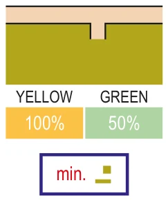
Area that shall not be entered (520): private gardens, yards, industrial sites. Yellow 100% plus green 50%. Entering means disqualification.
- Symbols
- 520
- Print (CMYK)
- 38 · 27 · 100 · 0
Swatches are approximate screen colours. CMYK values are from the IOF Printing and Colour Definitions, Rev. 4 (2024).
Runnability: the language of green
ISOM groups vegetation into five classes by the runner’s speed. Reference: a runner doing 4 min/km in flat, open forest.
| Class | Speed | Pace (min/km) | On the map | Examples |
|---|---|---|---|---|
| 1 · Easy running | > 100% | < 4 | 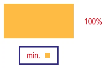 401Yellow, paved area, paths 401Yellow, paved area, paths | Lawns, tarmac, paths |
| 2 · Normal running | 80–100% | < 5 | 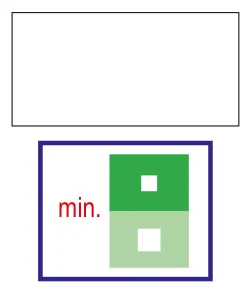 405White (405) 405White (405) | Open forest, rough open land |
| 3 · Slow running | 60–80% | 5–6:40 | 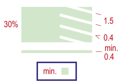 406Green 30% (406) 406Green 30% (406) | Dense vegetation, undergrowth |
| 4 · Walk | 20–60% | 6:40–20 | 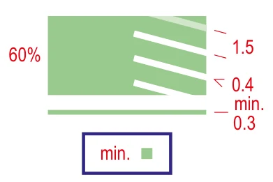 408Green 60% (408) 408Green 60% (408) | Dense trees and thickets |
| 5 · Fight | < 20% | > 20 | 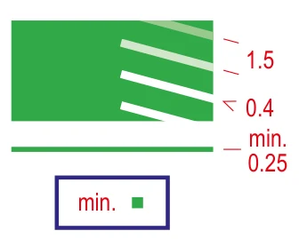 410Green 100% (410) 410Green 100% (410) | Barely passable vegetation |
White stripes left inside a green screen show that the vegetation is easier to pass in one direction. Where stony ground and green combine, speed is lower than either alone.
Scale, enlargement and contour interval
Base scale 1:15,000
All forest maps are generalised for 1:15,000. A 1:10,000 map is not drawn separately: the 1:15,000 map is enlarged to 150%, and every line, symbol and screen grows in proportion.
Who gets enlargements?
1:10,000 is always recommended for the youngest age groups. For older age groups, where fine lines become harder to read, enlarged maps are recommended in every format.
Map size
Maps larger than A3 are avoided; maps cut to fit a course are no smaller than A5. Cut maps still show scale, contour interval and north.
Contour interval 5 m
Standardised so steepness is easy to judge. In flat terrain with slopes under 5%, 2.5 m may be used; two intervals are never mixed on one map.
Form lines sparingly
A form line between contours makes the ground look nearly twice as steep, so it is used only for important landforms that contours cannot show.
Scales at IOF events (Competition Rules 2026, rule 15)
| Event type | Long | Middle and relay | Sprint |
|---|---|---|---|
| WOC, World Cup etc. | 1:15,000 | 1:10,000 | 1:4,000 |
| World Ranking Event (WRE) | 1:15,000 (1:10,000 if approved) | 1:10,000 (1:7,500 if approved) | 1:4,000 (1:3,000 if approved) |
| Masters (WMOC) | 1:10,000 or 1:7,500 | 1:10,000 or 1:7,500 | 1:4,000 or 1:3,000 |
At WMOC, 1:5,000 may be used for M/W80 and older with the IOF Event Adviser’s approval. The Turkish Orienteering Federation’s general competition rules (2019) set 1:4,000/1:5,000 for sprint, 1:7,500/1:10,000 for middle and relay, and 1:10,000/1:15,000 for long.
Generalisation and legibility
The mapper has four tools: selection (what goes on the map), simplification, displacement and exaggeration. The rule is clear: legibility always comes before absolute accuracy.
- 0.15 mm
- Minimum gap between two symbols (2.25 m at 1:15,000).
- 0.25 mm
- Minimum width of 100% green (3.75 m); 0.3 mm for 100% yellow, 0.4 mm for screens.
- 2 items
- Mandatory on the front of the map: scale and contour interval.
Accuracy is also judged from the runner’s point of view: a competitor using compass and pacing must perceive no discrepancy between map and ground. Relative height differences between neighbouring features matter more than absolute height. Maps should be georeferenced, but rotated to magnetic north before printing so the north lines run parallel to the paper edges.
Printing
Since 2024 the IOF recommends CMYK printing; at major IOF events 1:15,000 long-distance maps print brown as a separate spot colour (CMYK+B). Sprint, MTBO and ski-O maps are laser printed at 150 LPI or more. Course purple is placed below black, brown and blue so the detail underneath stays visible.
Why are sprint maps different?
ISSprOM’s key difference from ISOM: on a sprint map, thick black lines are used only for uncrossable features. In sprint, crossing them is not “hard” but forbidden.
Forbidden to cross or enter in sprint (Competition Rules 2026, rule 17.2)
- 520Area that shall not be entered (olive green): private gardens, flower beds, railway areas
- 521Building
- 515 · 518Uncrossable wall, uncrossable fence or railing (thick black line)
- 201 · 301 · 307Uncrossable cliff, body of water and marsh
- 411Uncrossable vegetation (dark green)
- 512.1Bridge or tunnel entrance (pass underneath only)
- 529Prominent uncrossable line feature
- 708 · 709 · 714Out-of-bounds boundary and area; temporary construction or closed area


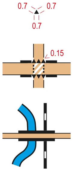
Sprint symbols: IOF ISSprOM 2019-2 (© IOF, CC BY-ND 4.0), unaltered.
Forest maps differ: only 520 (area that shall not be entered), 708 and 709 (out of bounds) and 711 (out-of-bounds route) are forbidden. A cliff or fence drawn as “impassable” in ISOM is not forbidden; it tells you it is dangerous or too difficult for the average elite orienteer.
Forest symbols: ISOM 2017-2.
A sprint map may show at most two running levels (for example above and below a bridge), only one of them in detail. The IOF has separate guidelines for complex urban structures (2022) and “Best practices for sprint mapping” (May 2025).
ISOM 2017-2 symbol catalogue
All 113 numbered symbols in Revision 6, including sub-numbers. Turkish names follow the Turkish Orienteering Federation’s ISOM 2017 translation; symbols added later were translated by the club.
113 symbols
| No | Symbol | Turkish | English | Type |
|---|---|---|---|---|
| Landforms 101–115 · brown | ||||
| 101 | 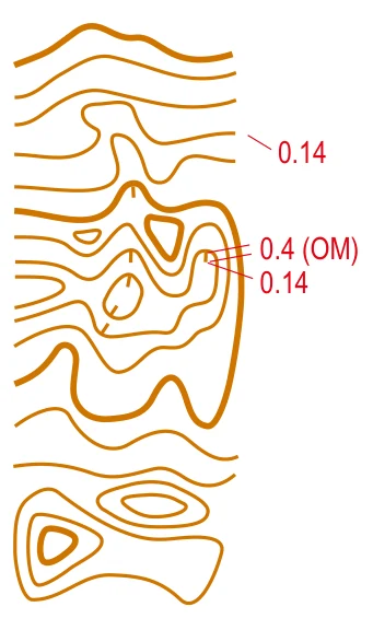 | Eşyükselti eğrisi | Contour | Line |
| 102 | 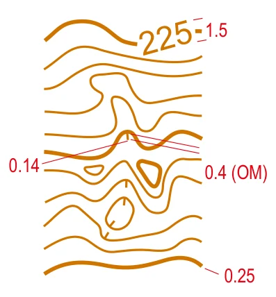 | Gösterge eşyükseltisi | Index contour | Line, Text |
| 103 | 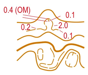 | Şekil çizgisi (yardımcı eğri) | Form line | Line |
| 104 | 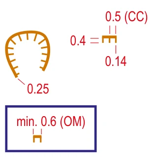 | Toprak set (yar) | Earth bank | Line |
| 105.1 | 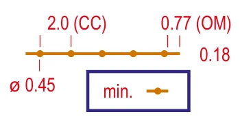 | Toprak duvar | Earth wall | Line |
| 105.2 | 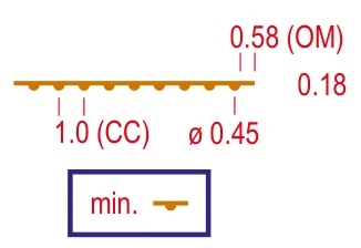 | İstinat toprak duvarı | Retaining earth wall | Line |
| 106 | 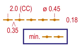 | Çökmüş toprak duvar | Ruined earth wall | Line |
| 107 | 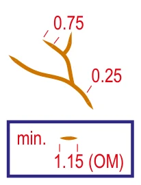 | Erozyon çukuru (yarıntı) | Erosion gully | Line |
| 108 | 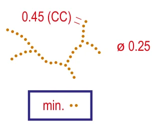 | Küçük erozyon çukuru | Small erosion gully | Line |
| 109 |  | Küçük tepecik | Small knoll | Point |
| 110 | 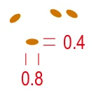 | Küçük uzun tepecik | Small elongated knoll | Point |
| 111 | 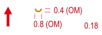 | Küçük çukur (çöküntü) | Small depression | Point |
| 112 | 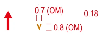 | Çukur | Pit | Point |
| 113 | 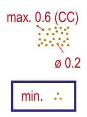 | Kırıklı arazi | Broken ground | Area |
| 114 | 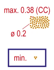 | Çok kırıklı arazi | Very broken ground | Area |
| 115 | 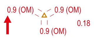 | Belirgin yer şekli öğesi | Prominent landform feature | Point |
| Rock and boulders 201–215 · black + grey | ||||
| 201 | 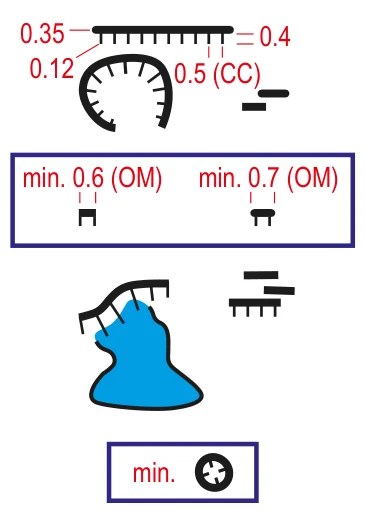 | Geçilemez sarp kayalık (uçurum) | Impassable cliff | Line |
| 202 | 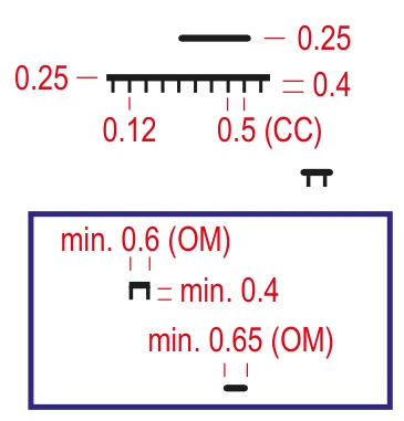 | Sarp kayalık | Cliff | Line |
| 203.1 | 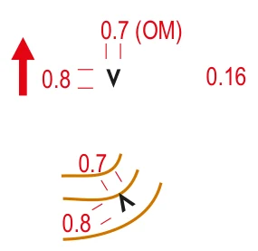 | Kayalık çukur veya mağara | Rocky pit or cave | Point |
| 203.2 | 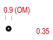 | Tehlikeli çukur | Dangerous pit | Point |
| 204 | 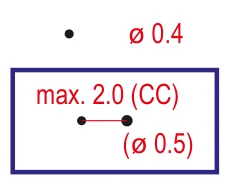 | Kaya kütlesi | Boulder | Point |
| 205 | 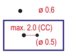 | Büyük kaya kütlesi | Large boulder | Point |
| 206 | 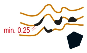 | Devasa kaya kütlesi veya kaya sütunu | Gigantic boulder or rock pillar | Area |
| 207 | 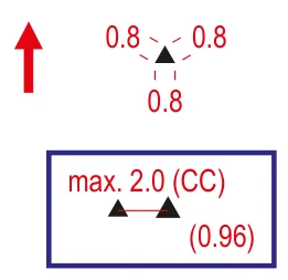 | Kümelenmiş kaya kütlesi | Boulder cluster | Point |
| 208 | 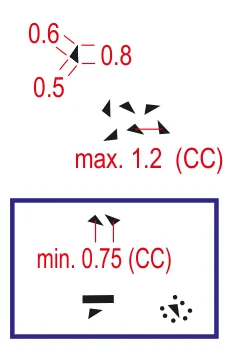 | Kaya parçası alanı | Boulder field | Area |
| 209 | 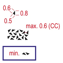 | Yoğun kayalık alan | Dense boulder field | Area |
| 210 | 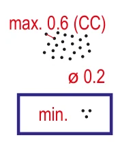 | Taşlık zemin, yavaş koşu | Stony ground, slow running | Area |
| 211 | 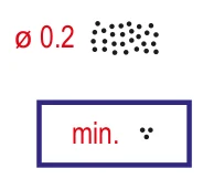 | Taşlık zemin, yürüyüş | Stony ground, walk | Area |
| 212 | 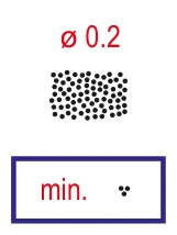 | Taşlık zemin, mücadele | Stony ground, fight | Area |
| 213 | 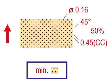 | Kumlu zemin | Sandy ground | Area |
| 214 | 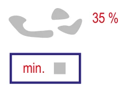 | Çıplak kaya | Bare rock | Area |
| 215 | 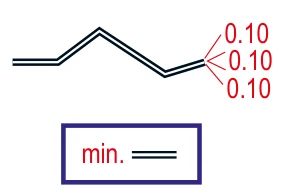 | Hendek | Trench | Line |
| Water and marsh 301–313 · blue | ||||
| 301 | 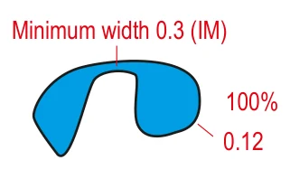 | Geçilemeyen su kütlesi | Uncrossable body of water | Area |
| 302 | 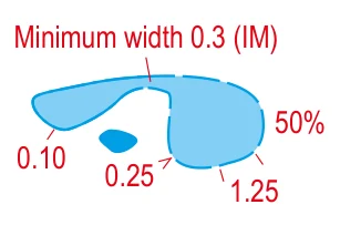 | Sığ su kütlesi | Shallow body of water | Area |
| 303 | 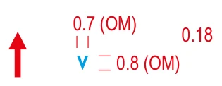 | Su çukuru | Waterhole | Point |
| 304 | 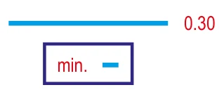 | Geçilebilir su yolu | Crossable watercourse | Line |
| 305 | 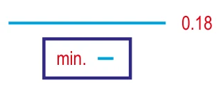 | Küçük geçilebilir su yolu | Small crossable watercourse | Line |
| 306 | 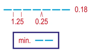 | Ufak / mevsimsel su kanalı | Minor/seasonal water channel | Line |
| 307 | 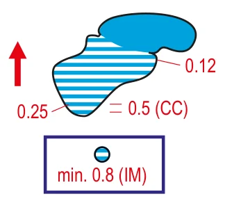 | Geçilemeyen bataklık | Uncrossable marsh | Area |
| 308 | 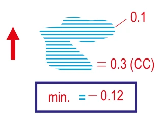 | Bataklık | Marsh | Area |
| 309 | 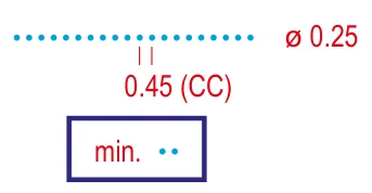 | Dar bataklık | Narrow marsh | Line |
| 310 | 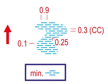 | Belirsiz bataklık | Indistinct marsh | Area |
| 311 | 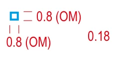 | Kuyu, çeşme veya su tankı | Well, fountain or water tank | Point |
| 312 | 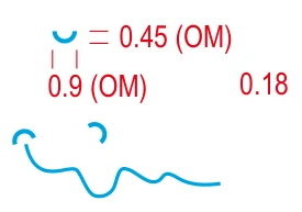 | Kaynak | Spring | Point |
| 313 | 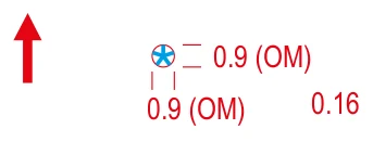 | Belirgin su öğesi | Prominent water feature | Point |
| Vegetation 401–419 · green + yellow | ||||
| 401 | | Açık alan | Open land | Area |
| 402 | 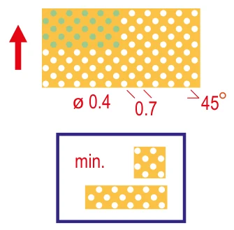 | Dağınık ağaçlı açık alan | Open land with scattered trees | Area |
| 403 | 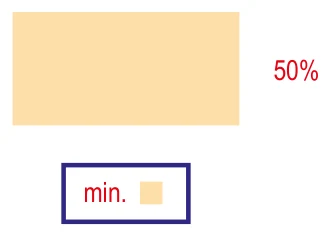 | Engebeli açık alan | Rough open land | Area |
| 404 | 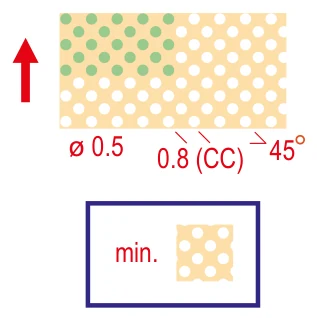 | Dağınık ağaçlı engebeli açık alan | Rough open land with scattered trees | Area |
| 405 | | Orman | Forest | Area |
| 406 | | Bitki örtüsü, yavaş koşu | Vegetation: slow running | Area |
| 407 | 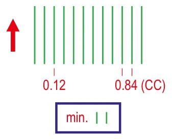 | Bitki örtüsü, yavaş koşu, iyi görüş | Vegetation: slow running, good visibility | Area |
| 408 | | Bitki örtüsü, yürüyüş | Vegetation: walk | Area |
| 409 | 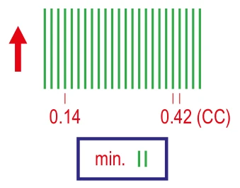 | Bitki örtüsü, yürüyüş, iyi görüş | Vegetation: walk, good visibility | Area |
| 410 | | Bitki örtüsü, geçilmesi zor (mücadele) | Vegetation: fight | Area |
| 412 | 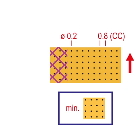 | Ekili alan | Cultivated land | Area |
| 413 | 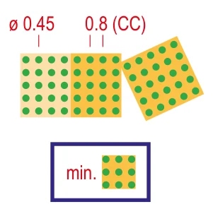 | Meyve bahçesi | Orchard | Area |
| 414 | 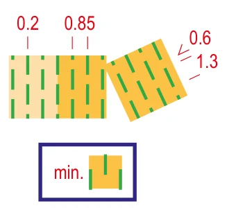 | Bağ veya benzeri | Vineyard or similar | Area |
| 415 | 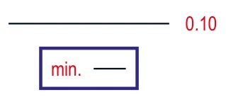 | Belirgin ekili alan sınırı | Distinct cultivation boundary | Line |
| 416 | 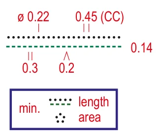 | Belirgin bitki örtüsü sınırı | Distinct vegetation boundary | Line |
| 417 | 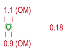 | Belirgin büyük ağaç | Prominent large tree | Point |
| 418 | 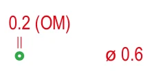 | Belirgin çalı veya ağaç | Prominent bush or tree | Point |
| 419 | 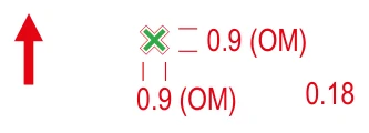 | Belirgin bitki örtüsü öğesi | Prominent vegetation feature | Point |
| Man-made features 501–532 · black | ||||
| 501 | 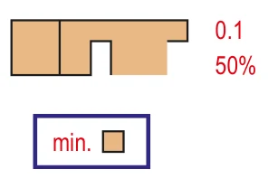 | Kaplı alan | Paved area | Area |
| 502 | 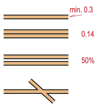 | Geniş yol | Wide road | Line |
| 503 |  | Yol | Road | Line |
| 504 | 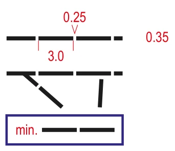 | Araç izi | Vehicle track | Line |
| 505 | 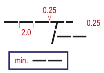 | Yaya yolu / patika | Footpath | Line |
| 506 | 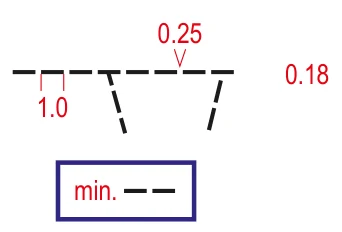 | Küçük patika | Small footpath | Line |
| 507 | 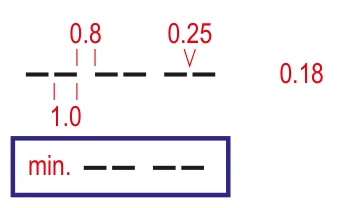 | Belirsiz küçük patika | Less distinct small footpath | Line |
| 508 | 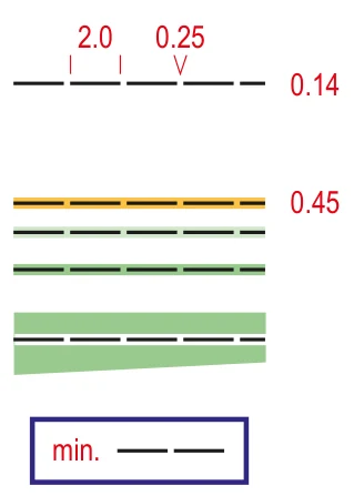 | Dar orman yolu veya doğrusal iz | Narrow ride or linear trace through the terrain | Line |
| 509 | 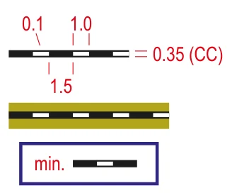 | Demiryolu | Railway | Line |
| 510 | 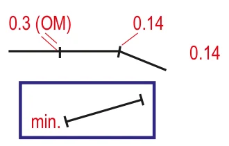 | Elektrik hattı, teleferik veya telesiyej | Power line, cableway or skilift | Line, Point |
| 511 | 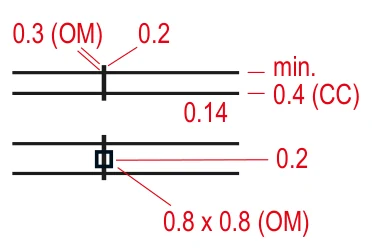 | Ana elektrik hattı | Major power line | Line, Point |
| 512 | 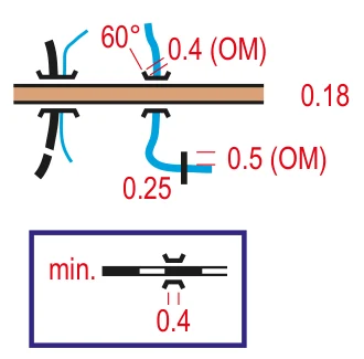 | Köprü / tünel | Bridge / tunnel | Line, Point |
| 513.1 | 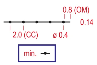 | Duvar | Wall | Line |
| 513.2 | 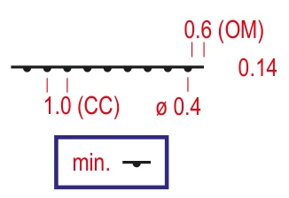 | İstinat duvarı | Retaining wall | Line |
| 514 | 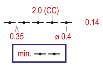 | Harabe duvar | Ruined wall | Line |
| 515 | 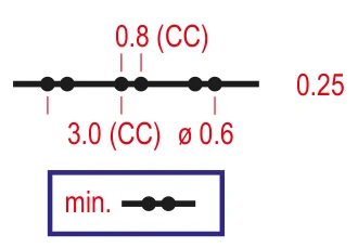 | Geçilemez duvar | Impassable wall | Line |
| 516 | 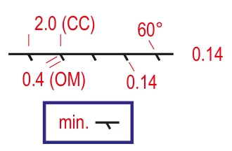 | Çit | Fence | Line |
| 517 | 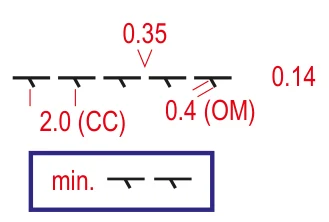 | Harabe çit | Ruined fence | Line |
| 518 | 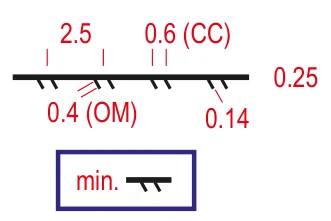 | Geçilemez çit | Impassable fence | Line |
| 519 | 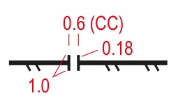 | Geçiş noktası | Crossing point | Point |
| 520 | 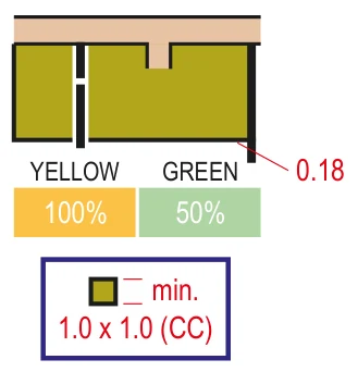 | Girilemez alan | Area that shall not be entered | Area |
| 521 | 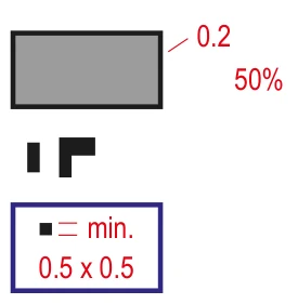 | Yapı / bina | Building | Area |
| 522 | 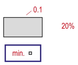 | Kanopi (sundurma) | Canopy | Area |
| 523 | 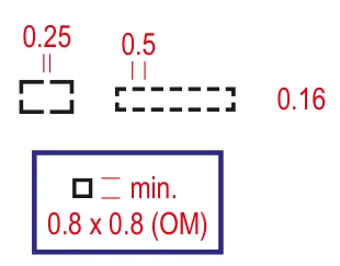 | Harabe | Ruin | Line |
| 524 | 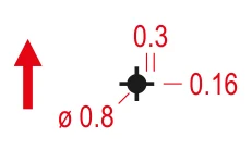 | Yüksek kule | High tower | Point |
| 525 | 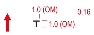 | Küçük kule | Small tower | Point |
| 526 | 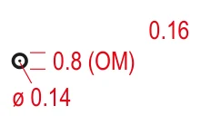 | Taş yığını | Cairn | Point |
| 527 | 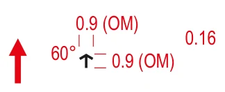 | Hayvan yemliği | Fodder rack | Point |
| 528 | 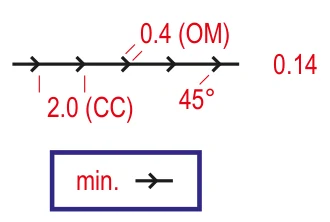 | Belirgin çizgisel öğe | Prominent line feature | Line |
| 529 | 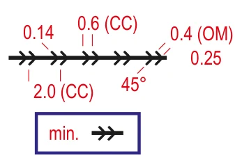 | Belirgin geçilemez çizgisel öğe | Prominent uncrossable line feature | Line |
| 530 | 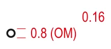 | Belirgin insan yapımı öğe – halka | Prominent man-made feature – ring | Point |
| 531 | 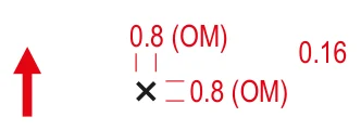 | Belirgin insan yapımı öğe – x | Prominent man-made feature – x | Point |
| 532 | 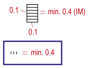 | Merdiven | Stairway | Line |
| Technical symbols 601–603 · black + blue | ||||
| 601 | 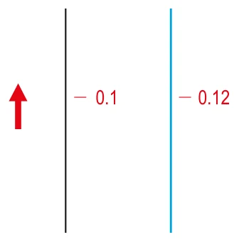 | Manyetik kuzey çizgisi | Magnetic north line | Line |
| 602 | 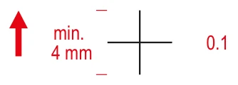 | Referans (çakıştırma) işareti | Registration mark | Point |
| 603 | 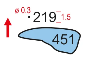 | Yükseklik noktası | Spot height | Point, Text |
| Course planning 701–715 · purple | ||||
| 701 | 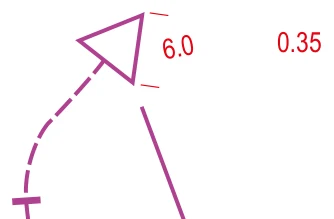 | Çıkış (start) | Start | Point |
| 702 | 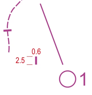 | Harita alma noktası | Map issue point | Point |
| 703 | 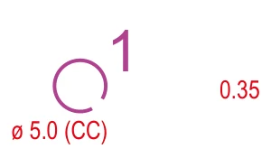 | Hedef (kontrol noktası) | Control point | Point |
| 704 | 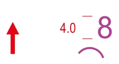 | Hedef sıra numarası | Control number | Text |
| 705 | 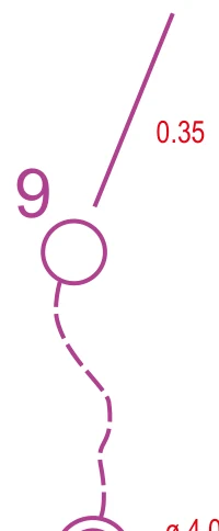 | Parkur çizgisi | Course line | Line |
| 706 | 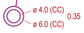 | Bitiş (finiş) | Finish | Point |
| 707 | 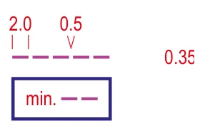 | İşaretli rota | Marked route | Line |
| 708 | 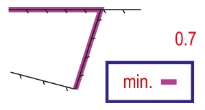 | Sınır dışı alan sınırı | Out-of-bounds boundary | Line |
| 709 | 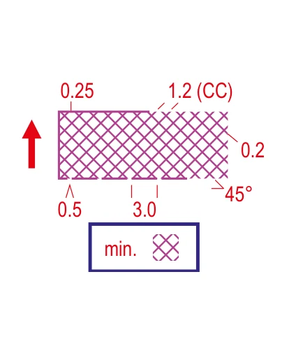 | Sınır dışı alan | Out-of-bounds area | Area |
| 710 | 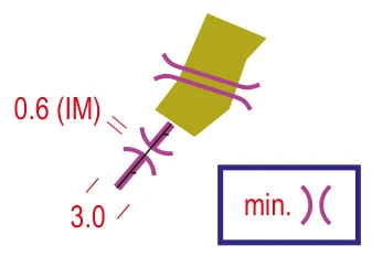 | Geçiş noktası | Crossing point | Line |
| 711 | 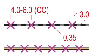 | Sınır dışı rota | Out-of-bounds route | Line |
| 712 | 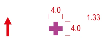 | İlk yardım noktası | First aid post | Point |
| 713 | 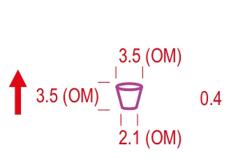 | İçecek noktası | Refreshment point | Point |
| 715 | 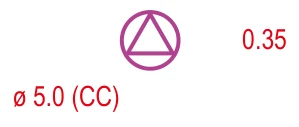 | Harita değişimi sonrası devam noktası | Continuing point after map exchange | Point |
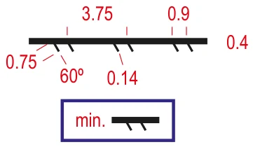
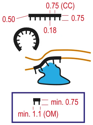
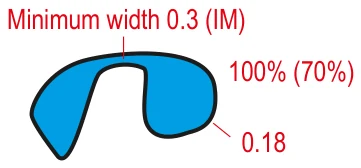
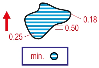
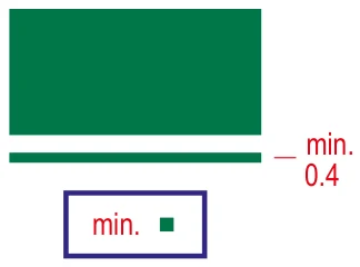
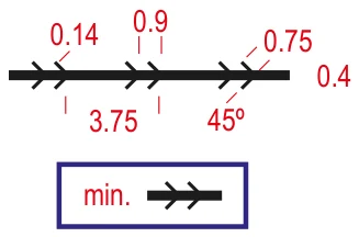
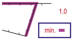
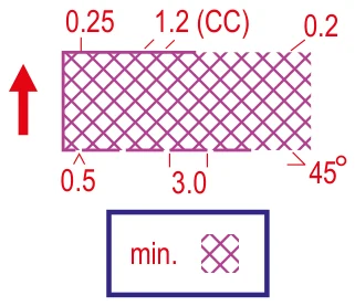
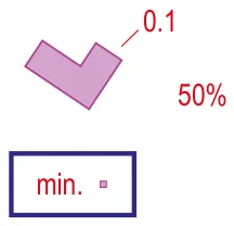
Symbol images are reproduced unaltered from IOF ISOM 2017-2 Revision 6 (© IOF, CC BY-ND 4.0). Red figures are drawing dimensions in millimetres at the 1:15,000 print scale; the blue “min.” box shows the smallest permitted form, and the red arrow marks symbols that must be oriented to north. Number 411 was removed in 2018; 714 exists only in the sprint specification. orienteering.sport/iof/mapping
Map approval and mapping in Turkey
In Turkey, orienteering maps are the responsibility of the Map Committee of the Turkish Orienteering Federation (TOF), made up of a Map Acceptance Commission and a Course Planning and Controllers Commission.
Registration
New maps are checked in OCAD format and in the field against ISOM / ISSprOM. A map scoring 90 or more on a 100-point checklist is accepted. Unregistered maps cannot be used at official races or permitted private races.
Event approval
Maps for permitted private races are sent to TOF in OCAD format at least 20 days before the event; without Map Committee approval the event cannot take place.
Mapper grades
Grade 1 (assistant mapper): town, park and school areas that need no contours. Grade 2: any terrain (one year’s experience, five accepted sprint maps, an 80-hour course). Grade 3: expert mapper.
Courses
TOF runs grade 1 mapping courses in Ankara (Pursaklar, January 2023; Ümitköy, January 2025). Announcements are published on the federation’s website.
This is a summary; TOF’s regulations in force are binding.
Map quality control at the IOF
The IOF reviews the maps of major events at the desk, following the method the Swedish federation has used since 2014. The map file goes to the Map Commission at least six months before the event; area and line symbol sizes are checked with OCAD tools, symbol shapes against a standard map, and form-line use and spacing by eye. The check takes about 1–1.5 hours and results in a list of errors and improvements.
Coming next: ISOM 2030 and ISSprOM 2031
ISOM 2030
In September 2024 the IOF Map Commission launched a comprehensive revision of ISOM. The focus is not new symbols but colours and the graphical appearance of the map: making use of better printing technology, improving legibility especially for runners with colour vision deficiencies, and countering ever more detailed maps with symbol definitions that support better generalisation. Federations’ suggestions closed on 30 September 2025; the first draft is planned for autumn 2026. All other specifications will then be based on ISOM 2030.
ISSprOM 2031
In a letter dated 15 September 2026 the IOF announced the revision of the sprint specification. It will focus on colours, graphical appearance, symbol parameters and complex urban terrain, with new symbols where they aid generalisation and legibility. Suggestions can be sent until 30 August 2027, approved by the national federation.
| Period | Stage |
|---|---|
| 09/2026 – 08/2027 | Call for proposals |
| 09/2027 – 05/2028 | Working and reference group work |
| 06/2028 – 01/2029 | First draft |
| 08/2029 – 09/2029 | Final draft and presentation |
| 10/2029 – 11/2029 | Approval |
| 02/2030 | Publication |
| 01/2031 | In force |
Have an idea for sprint maps? Write to us; as a club we will collect suggestions and pass them on through TOF.
Send your ideaMapping tools
OCAD
Swiss commercial software and the de facto standard for orienteering mapping. TOF reviews maps for registration in OCAD format. Includes LiDAR and digital elevation model tools.
ocad.com/en/orienteeringOpenOrienteering Mapper
Free and open source. Runs on Windows, macOS, Linux and Android, with ISOM 2017-2, ISSprOM, ISMTBOM and ISSkiOM symbol sets. The Android version lets you draw on a tablet in the field.
openorienteering.org/apps/mapperPurple Pen
Free course-setting software; works with OCAD and Mapper maps and generates control descriptions automatically.
purplepen.golde.orgKarttapullautin
Free tool that turns a LiDAR point cloud into a base map with contours, cliffs and vegetation.
github.com/grst/karttapullautinKanyon and maps
Kanyon Orienteering makes its own maps. Our park, campus, forest and school-ground maps are based on the standards on this page. Contact us about a map for your organisation or school, or for guidance if you want to start mapping.
Frequently asked questions
What is ISOM?
ISOM (International Specification for Orienteering Maps) is the International Orienteering Federation’s technical specification for forest orienteering maps. It defines which features are shown and with which symbols, colours and dimensions. The current version is ISOM 2017-2 Revision 6, mandatory since 1 January 2025.
What does white mean on an orienteering map?
White is open forest that can be run through at normal speed (ISOM 405). Beginners often take white for empty space; treeless open land is actually yellow, and vegetation that slows you down is green.
What scale are orienteering maps?
The base scale of forest maps is 1:15,000, used for long-distance races. For middle-distance and relay races the map is enlarged to 1:10,000. Sprint maps are 1:4,000, or 1:3,000 when enlarged.
How is a sprint map different from a forest map?
Sprint maps (ISSprOM) are 1:4,000 with a 2–2.5 m contour interval and show urban detail more richly. The key difference is that thick black lines are used only for uncrossable features, and crossing them is forbidden.
What happens if I enter an olive-green or purple-hatched area?
Olive green (520) marks areas that shall not be entered and purple hatching (709) out-of-bounds areas. Under the IOF Competition Rules a competitor who enters them can be disqualified. These are often private property or protected nature.
Who approves orienteering maps in Turkey?
The Map Committee of the Turkish Orienteering Federation (TOF). Maps are checked in OCAD format and in the field against ISOM / ISSprOM; a map scoring 90 or more on a 100-point checklist is registered. Unregistered maps cannot be used at official races.
How can I learn to draw orienteering maps?
Start with a school ground or park map in the free OpenOrienteering Mapper. TOF’s grade 1 mapping courses qualify you for park, town and school maps that need no contours. Kanyon Orienteering’s mappers are happy to help beginners.
When will the next version of ISOM appear?
The IOF Map Commission is working on ISOM 2030; the first draft is planned for autumn 2026. The focus is not new symbols but colours, graphical appearance and legibility for runners with colour vision deficiencies. The new sprint specification, ISSprOM 2031, will come into force in January 2031.
Sources
- IOF — Mapping (ISOM, ISSprOM, ISMTBOM, ISSkiOM, baskı ve renk tanımları / printing and colour definitions)
- IOF — Map Commission
- IOF O-Map Wiki
- IOF — Updates to ISOM 2017 approved (2018)
- IOF — New map specifications for MTBO and sprint published (2022)
- IOF — International Specification for Control Descriptions updated (2023)
- IOF — Revision of ISOM, letter to member federations (18.09.2024); Revision of ISSprOM (ISSprOM 2031), letter (15.09.2026); Control process of the mapping for major IOF events (July 2026); IOF Foot Orienteering Competition Rules 2026
- TOF — Harita Kurulu Talimatı
- ISOM 2017 — Oryantiring Haritaları İçin Uluslararası Teknik Şartname (TOF Türkçe çevirisi, ISOM 2017 esaslı)
- TOF — 1. Kademe Haritacılık Kursu, Ankara (Ocak 2025)